Larry has established himself as a solid team builder and player in the GIS, 3D, visualization, and realtime simulation software environment
Geographic Information Systems Projects
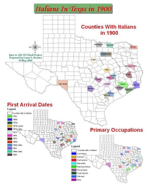
Larry is an active part of the exciting and quickly expanding world of GIS and continues to read and learn more about the subject. His particular interest is in using GIS to create history-oriented analysis projects. One of his first maps was showing Italians in Texas in 1900, a look at the counties who had Italian immigrants in 1900, when the arrived in those counties, what their primary occupations were, and where they came from in Italy. Here’s what it looks like:
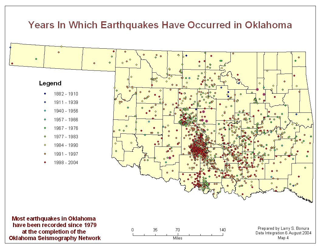
He also did a comprehensive look at earthquakes in Oklahoma from 1882-2004. Here’s a sample of some of that data:
Continuing Education
- 2004
- Currently enrolled in GIScience Certificate Program, Louisiana Tech University
- Introduction to GIS
- Data Integration in GIS
- Spatial Analysis in GIS
- Spatial Analysis of Geohazards Using ArcGIS, ESRI
- ArcGIS 9 Seminar, ESRI
- GeoDa, Word Workers
- GIS and Business Intelligence for the Enterprise, ESRI
- What Is ArcGIS?, ESRI
- Advanced Terrain Construction with CTS, Word Workers
- Color Basics for GIS Users, Word Workers
- Anthropology, Space, and Geographic Information Systems, Word Workers
- Getting Started with ArcObjects in ArcGIS, ESRI
- Mapping the News, Word Workers
- Currently enrolled in GIScience Certificate Program, Louisiana Tech University
- 2003
- Managing Natural Resources with GIS, Word Workers
- Introduction to MapServer, MapServer
- GIS: What’s the Big Picture, NMGIC
- GIS in Site Design, Word Workers
- How to Lie With Maps, Word Workers
- Getting to Know ArcGIS Desktop, ESRI
- City of Fremont: Changing Practice of Local Government, MapInfo
- A Place in History: A Guide to Using GIS in History, History Data Service
- Understanding Map Projections, ESRI
- Geographic Information Systems and Science, Word Workers
- Homeland Security System, MapInfo
- Modeling Our World: ESRI Guide to Geodatabase Design, ESRI
- LADBM, MultiGen-Paradigm
- The GIS Book, ESRI
- Creator and VSG/Vega Prime Light Point Integration, MultiGen-Paradigm
- Competitive Products: LBI and GIS Products, Word Workers
- Past Time, Past Place: GIS in History, ESRI
- GIS for Everyone, ESRI
- How Vancouver Delivers GIS Information Online, Autodesk
- Introduction to Creator Terrain Studio v1.1, MultiGen-Paradigm
- Introduction to MultiGen-Paradigm Creator v2.6, MultiGen-Paradigm
- 2002
- Researching the Sanborn Fire Insurance Maps Online, Preservation Dallas
- 3D Modeling and Rendering, Richland College
Software Knowledge
Here’s a table showing Larry’s expertise in GIS software:
|
|
|
| Tool | Skill Level (1=Basic Understanding; 5=Expert) |
|---|---|
|
|
|
| AGIS | 1 |
| ArcGIS Desktop: ArcMap, ArcCatalog, ArcToolbox, ArcScene | 3 |
| ArcExplorer | 5 |
| Creator Terrain Studio | 3 |
| GeoDa | 1 |
| GeoSurf | 3 |
| Global Mapper | 1 |
| Import 71 | 5 |
| MapInfo ProViewer | 5 |
Memberships
Larry is an active member of several professional GIS organizations:
